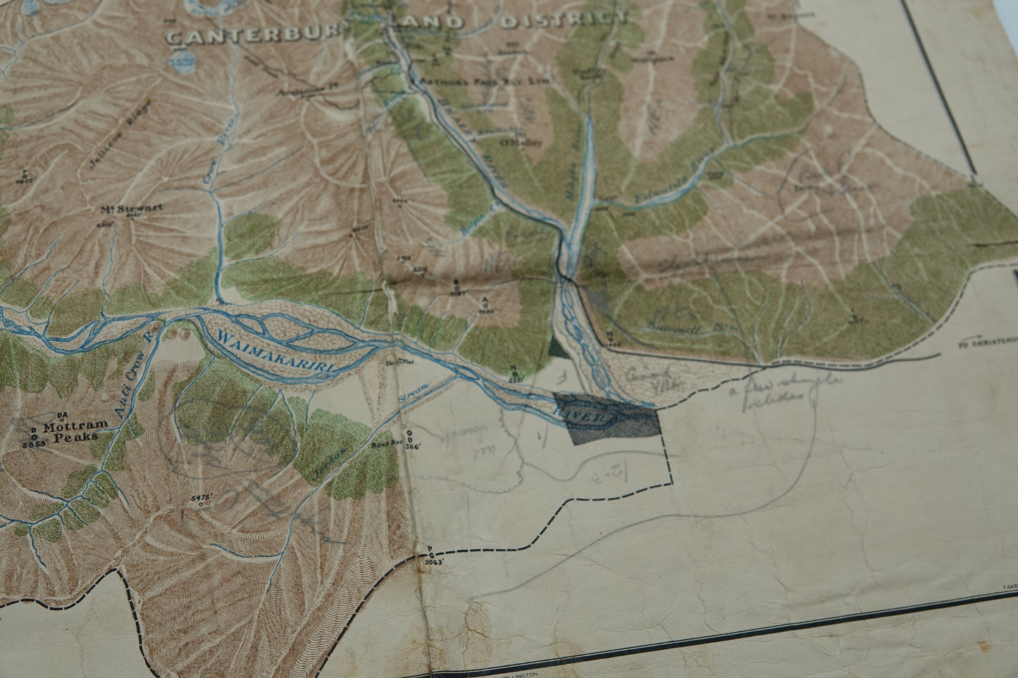
Rare hand drawn canvas map - Arthurs Pass National Park 1931
Rare hand drawn canvas map - Arthurs Pass National Park 1931
Couldn't load pickup availability
Arthurs Park National Park was opened in 1929. This stunning park is located in the South Island of New Zealand and covers 1,185 km2 of mostly mountainous terrain which this hand coloured beauty does real justice to!
Hand drawn by A J Wicks, Chief Draughtsman, Lands and Survey Department and T Cagney, Chief Surveyor Westland. It measures 475mmx580mm.
Has some hand written pencil notations and a corner stamp from its owner "District Pedologist Wellington"
Condition is G+ for its considerable age. Edge wear to canvas and minor splits but will still frame up very nicely.
Condition Guide
Condition Guide
Every item we offer has a story, and its condition is an important part of that tale. Our Condition Guide provides clear descriptions of the state of each book or artifact, so you know exactly what to expect before making a purchase.
We encourage you to take a moment to review the guide and consider the condition carefully when making your decision. If you'd like to experience these treasures firsthand, you're warmly invited to visit us at our Mt Eden store—we’d love to meet you and help you explore our collection in person.
To view our condition guide, click here.
Shipping and Returns
Shipping and Returns
Standard shipping:
Orders are processed within one working day of the order being placed. Once processed, our standard delivery times are between 3-5 working days (within the Auckland region). Rural deliveries may take an additional 1–2 days.
Standard shipping rates start from $7.50. For bulky/heavy/fragile items, or international delivery, additional shipping costs may apply. If you're unsure, email placeholder for a quote. Otherwise, an estimate will be emailed to you when your order is processed.
To view our online returns policy, click here.